
Accurate data is an advantage
About 2GIS data
We will tell you how we achieved 95% accuracy of the data, on which all our products and solutions are made.
Always up-to-date data
Image decryption by artificial intelligence
Traffic Sign Recognition with Computer Vision
User feedback
Contact Center Verification
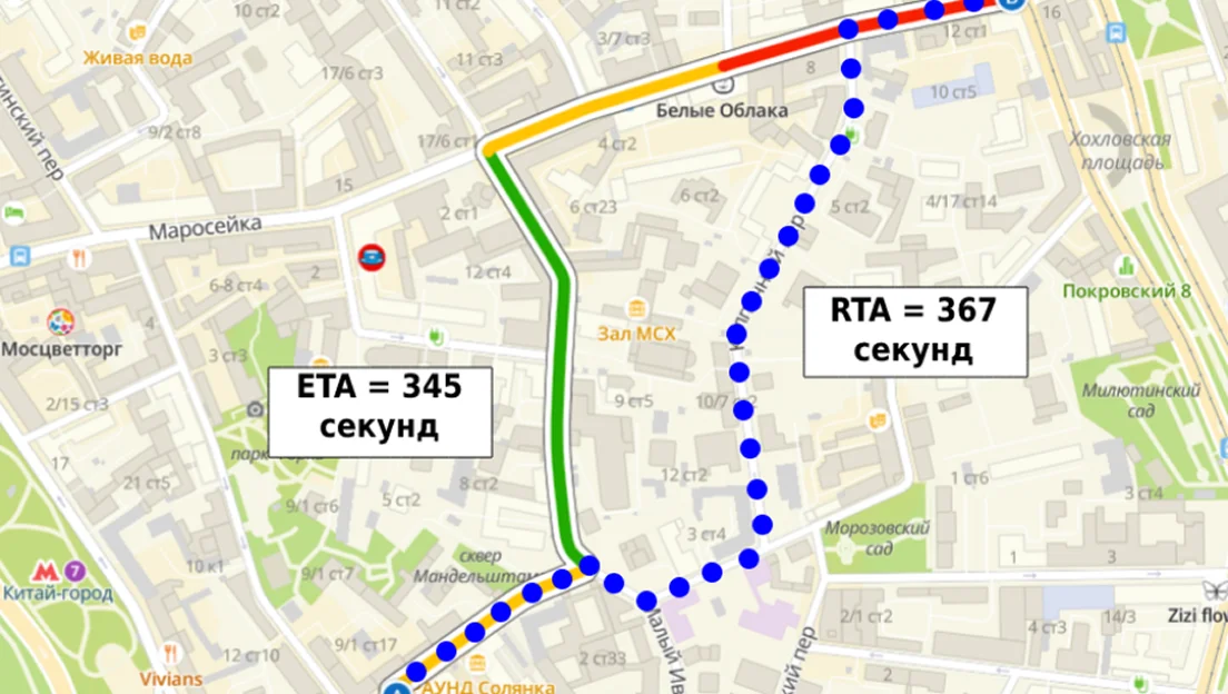
Machine learning: Recognition of passages and roads based on user movement tracks
Field reconciliation by cartographers
Proprietary technologies for data collection and updating
Hundreds of employees and millions of users are involved in the collection and updating of 2GIS data. For these tasks, we use our own technologies

01
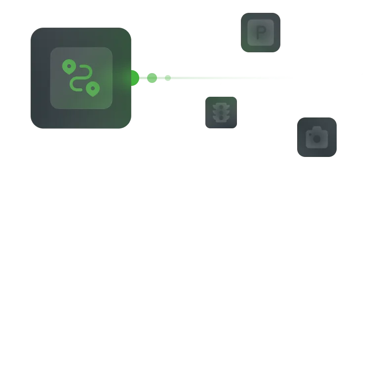
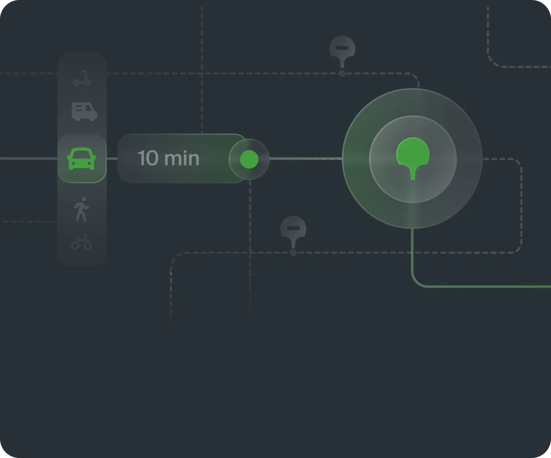
Working with navigation data
The app collects and analyzes data by using dashboard camera, recognizes markings, every road sign and traffic light by using our ML algorithm

02
Map creation
Fiji — is our own GIS system, in which we create a cartographic basis: from decoding satellite imagery to adding individual layers and the smallest details to the map

03
Field reconciliation
Youla is a mobile application that helps to update data and add objects on the ground by pedestrian mappers

04
Collection and verification of data on organizations
InfoRussia is a system that allows you to collect, store, and update information about dynamically changing data. Integrated with telephony, IVR and artificial intelligence
Data synergy
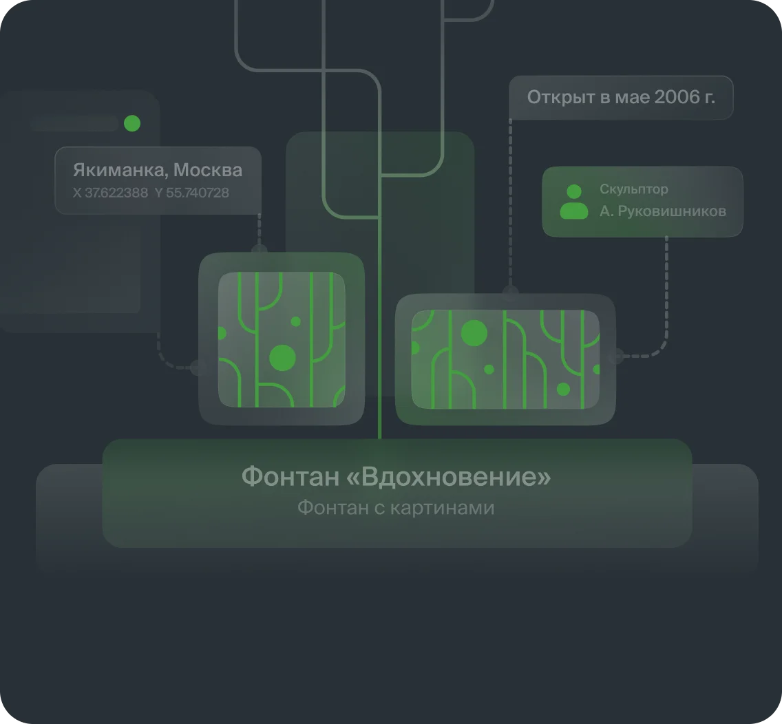
Collecting data isn`t enough — we have created a data processing technology to link any information to geocoordinates. Thanks to this, you can be sure that each feature on the map has a specific address, and this address is accurate and exists.


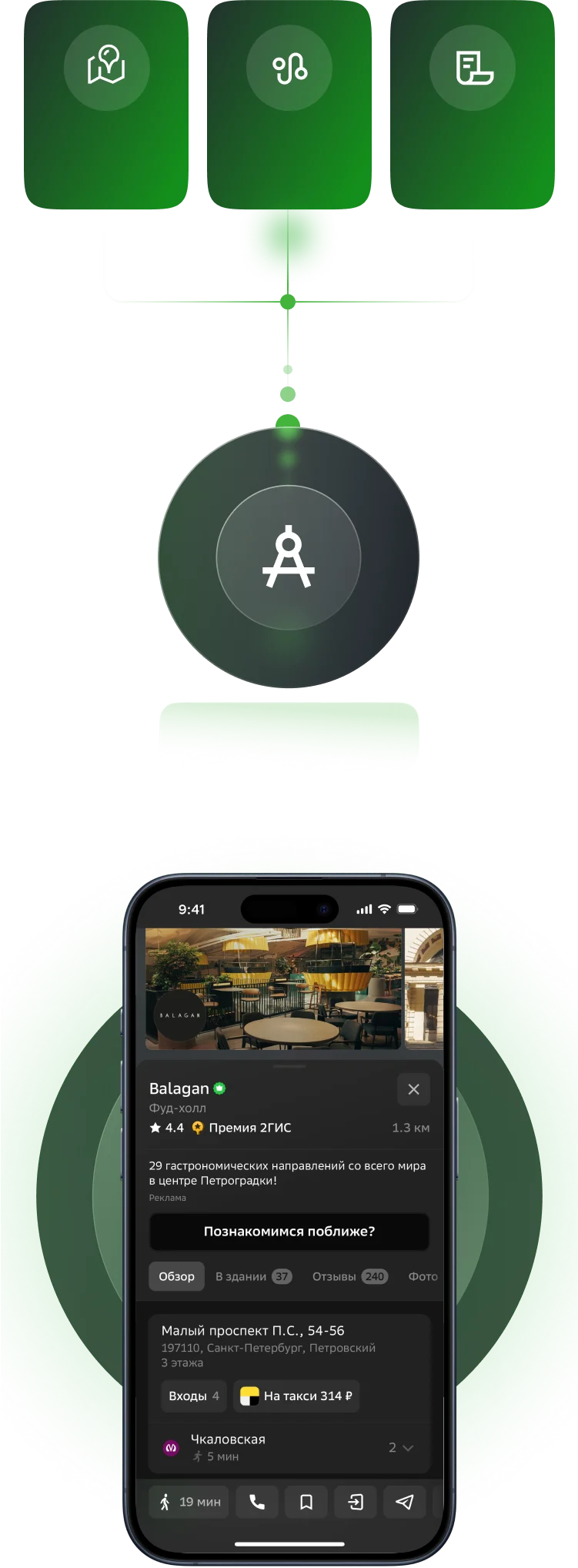
Map
Directory
Geo-Linking
In which building is the company located and where is the entrance located?
How to build a route to the company and where is the best place to park?
How to find a company by TIN?
Maximum detail and data completeness
Beautiful maps
Our passion and pride is an accurate and detailed map that has everything from gates to new buildings.
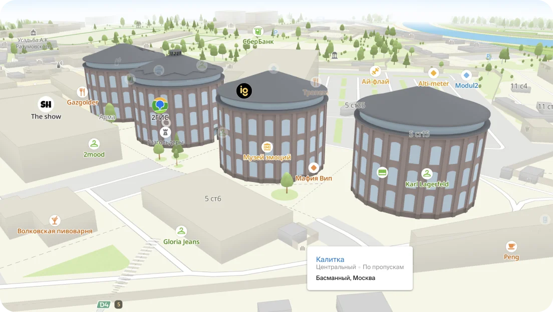
The map contains many details — paths, fences, stairs, barriers, trees, small architectural forms and other objects that can serve as a landmark on the ground.

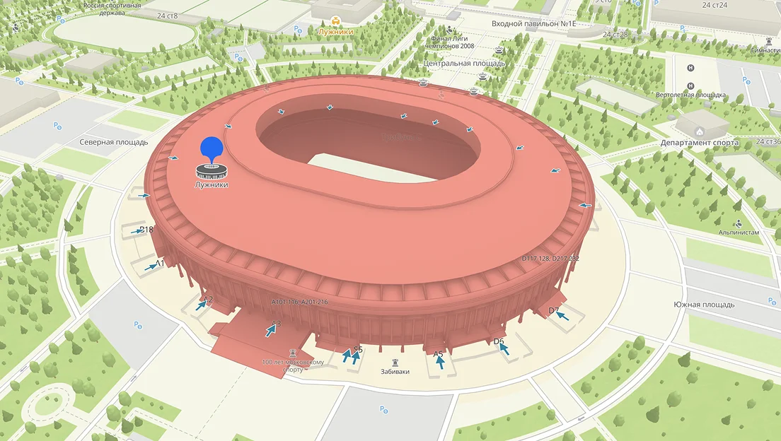
For the largest buildings, airports, shopping centers, cultural and transport facilities, the detail is even higher — floor plans of the premises have been collected.

Popular places and basic infrastructure are marked with icons to help you navigate better.

The map contains realistic 3D models that repeat the volume and geometry of the main elements of buildings and transport interchanges, so that the user can enjoy a beautiful three-dimensional map.

For complete immersion, we draw immersive objects on the map — look at realistic copies of locations, even before the buildings are commissioned. We accurately recreate building facades, architectural elements, floor plans, landscape design and landscaping elements.


Delivery of data in all formats
We provide data in a variety of ways, from data sampling files to cloud service integration and closed-loop deployments.


Digital satellite images verified on the ground
Digital satellite images verified on the ground
Reference data for millions of buildings, organizations, and POIs
Reference data for millions of buildings, organizations, and POIs
Search queries of millions of users of the 2GIS application
Search queries of millions of users of the 2GIS application

Data in pure form
CSV, XLSX, JSON, XML, MID/MIF, Shape

Services
On-Cloud
On-Premise

Services for business and the public sector

Digital satellite images verified on the ground
Reference data for millions of buildings, organizations, and POIs
Navigation, road, cargo, hiking and transport graph
Search queries of millions of users of the 2GIS application
Data in pure form
CSV, XLSX, JSON, XML, MID/MIF, Shape
Services
On-Cloud
On-Premise
Services for business and the public sector
Four reasons to choose 2GIS